Hanoi (VNA) – A workshop on applying geographic information system (GIS) technology for priority setting and decision support in post-war mine action was held in Hanoi on September 30, aiming to share initial results of a pilot study in central Quang Ngai province.
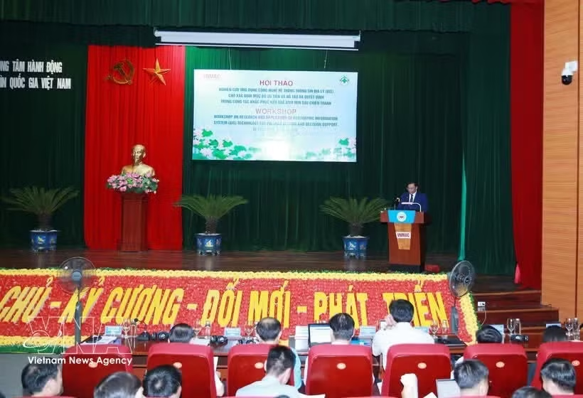
The workshop was co-organised by the Vietnam National Mine Action Centre (VNMAC) and Norwegian People’s Aid (NPA).
The study combines wartime bombing data, field survey results, population density, land-use planning and other socio-economic factors to develop priority maps. It demonstrates the potential of GIS to improve the efficiency of efforts to address the consequences of bombs, landmines and unexploded ordnance (UXO) in Vietnam.
Ha Dinh Huong, Standing Deputy Director General of VNMAC, said that although the war ended decades ago, remnants of bombs, mines and other explosive materials remain a major challenge to public safety and sustainable socio-economic development in many localities.
The Party and State, particularly the Ministry of National Defence, have paid close attention to the issue, maximising resources and working closely with international organisations to accelerate the clearance of contaminated land, he said.
Huong noted that the identification of areas requiring UXO clearance previously relied mainly on maps of suspected contaminated areas (BMA) produced through broad-area surveys. However, the suspected contaminated area is vast while financial, human and equipment resources remain limited.
Therefore, relying solely on contamination data may not ensure that resources are allocated in line with the urgent development needs of individual localities. Mine-action managers need scientific tools to convert technical data into practical decisions, he said.
Facing that fact, VNMAC, in coordination with NPA and with funding from the US Government, launched a pilot study in Quang Ngai to develop a GIS-based prioritisation and decision-support method.
The study adopts an approach that integrates multiple data layers instead of assessing only the risks posed by bombs and mines. The five core criteria consist of bomb and mine density, suspected contaminated areas, population density based on address data, accident-risk hotspots, and land-use changes under the province’s 2021–2030 development plan.
The model then provides visual rankings of risk levels – low, medium and high – through colour-coded maps for each commune and each 500m-by-500m grid cell.
According to the organisers, the model could provide a scientific basis for central and local agencies to make more accurate and effective decisions on prioritising resources for UXO clearance.
Participants at the workshop discussed ways to improve the priority index to ensure its scientific validity and feasibility under the diverse conditions of different localities. A roadmap was also considered for developing a shared GIS data platform to support management and decision-making at different levels.
They reviewed the pilot study’s methodology and results in Quang Ngai and received feedback from provincial departments, local authorities and international organisations to refine the indicators and weighting system in line with Vietnam’s practical needs.
They also discussed the potential for applying the research findings in practice and expanding priority risk mapping to other localities nationwide.
Representatives from Quang Ngai said several issues need to be addressed to turn the results into an effective management tool, including establishing a continuous two-way data-updating mechanism to ensure accurate and up-to-date information, developing a shared WebGIS platform, and strengthening training and technique transfer for grassroots officials./.